![kudurrustone-logo.png]](https://kb.kudurrustone.com/hs-fs/hubfs/kudurrustone-logo.png?height=40&name=kudurrustone-logo.png)
Where This Is Done
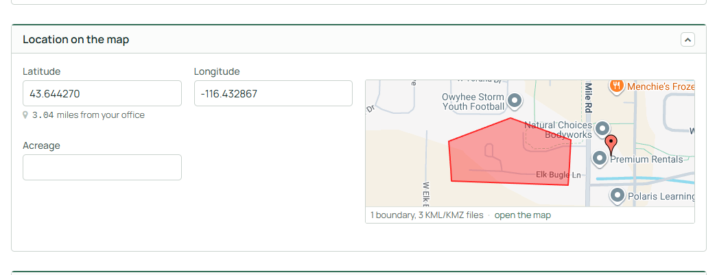
Open a quote from the Quote Dashboard, then look on the General tab. The Location tile sits beside the Latitude and Longitude boxes. It shows a small map of where the quote is, and a caption across the bottom that reads something like "1 boundary, 3 KML/KMZ files - open the map". A quote with no point and no boundary shows a blank tile instead.
Directly under the Latitude and Longitude boxes is a quiet line reading "N miles from your office". That is the straight line distance from your company office location to the quote's point, and it updates as soon as the point changes.
Click anywhere on the tile to open the Location window.
What This Affects
The point (Latitude and Longitude) is written into the Latitude and Longitude fields on the quote form when you click Done.
The boundary is saved immediately when you click Done.
Attaching or deleting a KML or KMZ file also takes effect immediately. Files you import are stored with the quote's files in a folder named KML.
The acreage figure shown at the bottom of the map is a readout of the boundary you have drawn. It is not copied into the Acreage field on the quote.
How to Set a Quote's Location
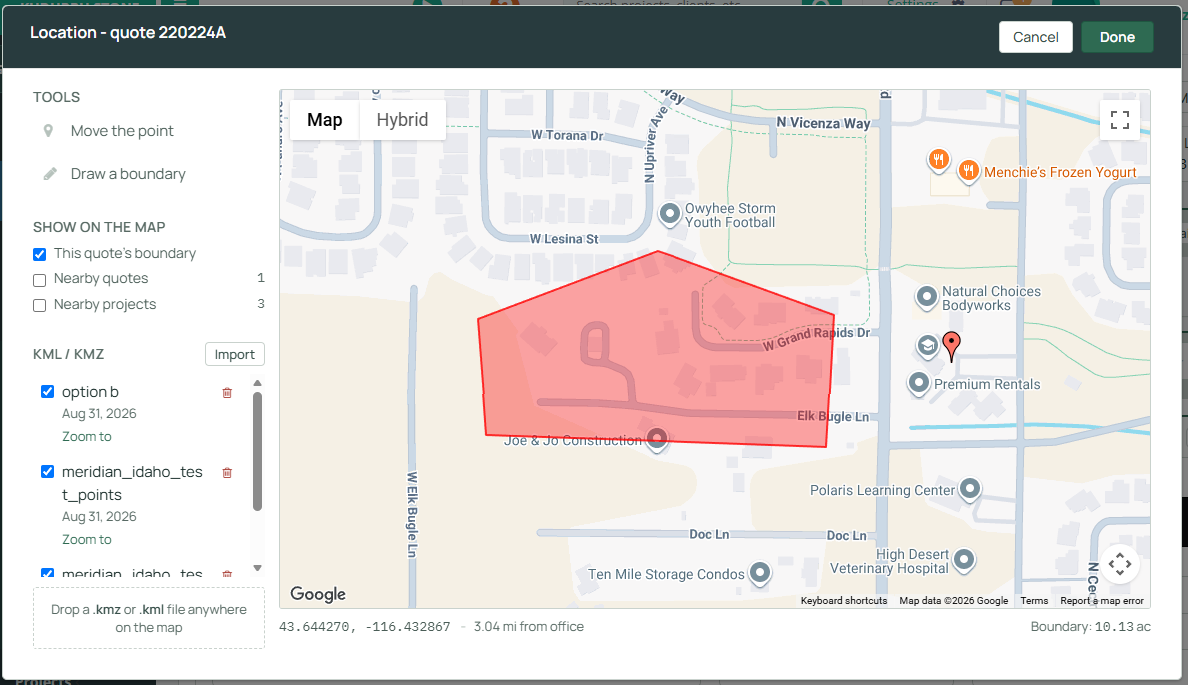
- Open the quote and click the Location tile on the General tab. The Location window opens with the map on the right.
- To set or move the quote's point, click Move the point in the Tools block, then click the map where the quote belongs. You can also drag the red pin. The readout under the map shows the coordinates and the distance from your office as you move it.
- To draw a property boundary, click Draw a boundary. Click the map once for each corner. Drag a corner to move it. Use Undo point to remove the last corner you placed, or Start over to clear the shape and begin again. The acreage of the shape appears at the right end of the readout line and updates as you work.
- To see context around the quote, use the Show on the map block. This quote's boundary is on by default. Check the boxes for Nearby quotes or Nearby projects to drop pins for other records inside the current map view. The number beside each one tells you how many are in view before you turn the layer on. Clicking one of those pins opens that quote or project in a new browser tab.
- To attach a boundary file, click Import in the KML / KMZ block and pick a .kml or .kmz file, or drag the file from your desktop and drop it anywhere on the map. The file uploads straight away and appears in the list below.
- Each file in the list has its own tick box, a Zoom to button, and a trash icon. Untick a file to hide it without deleting it. Zoom to fits the map around that file, switching it back on first if it was hidden.
- Click Done when you are finished. Click Save on the quote afterward so the new coordinates are recorded.
Locked Quote
When a quote has been accepted and locked, the Tools block is replaced with a note saying the point and the boundary cannot be changed. The map, the layers, the file list, Zoom to, and each file's tick box all still work, so a locked quote can still be read. Import and the delete icons are not shown.
To change the point or the boundary on a locked quote, the quote has to be unlocked first. Unlocking requires a reason and is restricted by role, so not every user will see that option.
Three Corner Boundary
A boundary needs at least three corners. If you have started or changed a boundary and click Done with fewer than three, the map shows "Draw at least three boundary points before saving, or Cancel to leave it as it was." Either finish the shape or click Cancel.
Cancel
Cancel throws away everything you did in the map window since you opened it. A point you moved but did not confirm with Done is discarded, and a boundary you were drawing is re-read from the server the next time the window opens. Anything already saved by a previous Done, and any file you imported or deleted, is not affected.
Tips
- Set the point before drawing the boundary. The map centers on the point when it opens, which saves hunting for the property.
- Switch to Satellite before drawing. Tracing a boundary against aerial imagery is far faster than against a road map.
- Turn on Nearby projects before quoting travel. The count beside the checkbox tells you whether there is other work in the area without cluttering the map.